
Weather

Local Radar
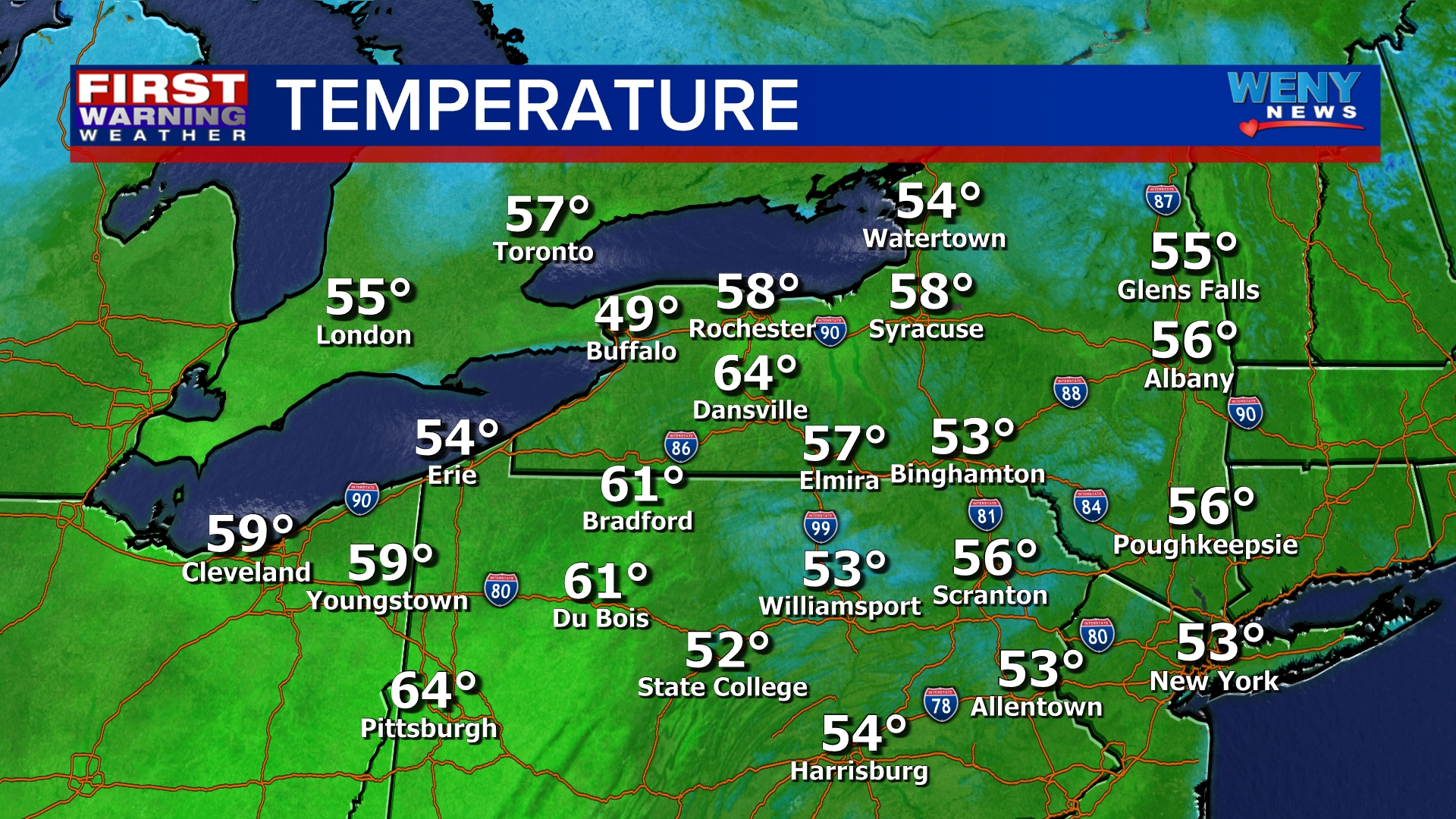
Current Temps

Current Conditions

Regional Radar
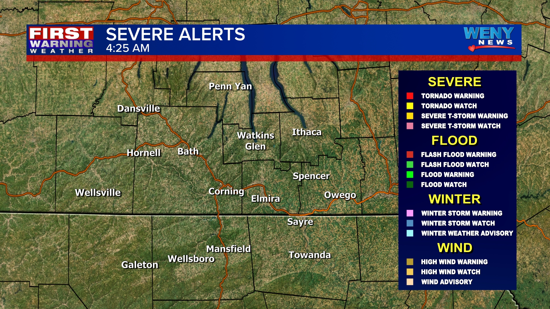
Watches and Warnings

12 Hour Forecast

24 Hour Forecast

7 Day

Featured
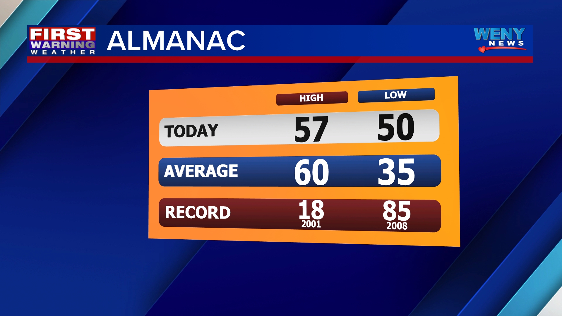
Almanac
Seneca Lake Sky Cam
Sponsored by Boss Security
Airport Sky Cam
Sponsored by Boss Security
Horseheads Sky Cam
Sponsored by Arnot Health
Gaffer District Sky Cam
Sponsored by Corning's Gaffer District
Mansfield Sky Cam
